

具体描述
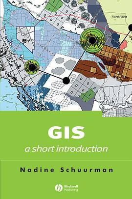
This guide enables students of human geography to take a critical look at the set of practices, hardware and software that are together described as GIS. A guide to GIS for students of human geography. Outlines the distinct approaches to inquiry employed in GIS and illustrates their relevance for human geographers. Traces the history of GIS and human geography from 1970 to the present. Illustrates the challenges of data collection, classification in the context of multiple stakeholders and epistemological approaches. Tracks the use of GIS in applied contexts through the stages of problem definition, data acquisition and classification, choice of software, spatial analysis and graphic output. Includes an inventory of tools and information related to GIS, including web-based resources. Supported by a website, www.blackwellpublishing.com/schuurman.
作者简介
Nadine Schuurman, Ph.D. University of British Columbia, 2000.
Department of Geography, Simon Fraser University, Faculty Member
Research Interests:
I am a GIScience (GIS) researcher with a focus on improving population health data and analysis in the interests of more reliable and more detailed spatial analysis. In the past, I have studied the processes by which theoretical knowledge is constructed in GIS with particular attention to generalization (the elimination of detail as scale decreases) and data models or the conceptual basis for representation in the digital realm. This theoretical emphasis led to an interest in data integration or ways of linking disparate data sets with some related elements. Typically it involves linkages between different registries within one jurisdiction or, alternatively, comparison of similar but not identical datasets between jurisdictions (e.g. provinces). My initial research in this area focused on ground water data. I developed a large data standardization project working with sub-surface groundwater data from bore-holes and created two graphical user interface (GUI) to standardize and classify this data for use in groundwater flow modelling
Since 2002, my research has focused on GIS and health informatics. This is the only GIS research program in Canada dedicated to the development of new technologies, methodologies and protocols for studying population health and health services using GIS and spatial data. I have a small research group (7 graduate students and research assistants) that is involved in several complementary and supporting projects. Our goal is to create a research environment that can assist policy makers and health administrators understand and rationalize choices about service provision based on spatial data, population vulnerability, access, service availability, trajectories and outcomes. I have four long-term research objectives: (i) develop decision frameworks for location of health services; (ii) build new spatial approaches to analyzing and characterizing access, availability and outcomes of trauma cases; and (iii) enhance the quality of semantic data linkages between multiple registries; and (iv) develop high resolution urban data sets that permit investigation of links between the built environment and population health.
(i) Decision frameworks for location of health services. Location/allocation of hospital services is a key component of a stream-lined health care system. I am working on spatial algorithms that will allow administrators to evaluate the catchment area associated with a specific service at any hospital and then determine the denominator population associated with that service area. This modelling tool will allow us to determine the population to be served by regional hubs and tertiary centres as well as regional age/sex proportions. I am also developing a Graphical User Interface (GUI) to this methodology so that policy makers will be able to visualize the effects of changes to service provision on the denominator population on-the-fly using icon-driven mapping software.
Another health services project involves using Multi-Criteria Evaluation (MCE) to evaluate optimal locations for adding or subtracting maternity care services in rural BC. This research is a small part of a larger CIHR grant (PIs: Drs. Jude Kornelson and Stefan Gryzbowski) developed to investigate the vulnerability of rural women based on access and availability of maternity care.
(ii)Spatial epidemiology of trauma/injury in Sub-Saharan Africa. I am a co-leader (with Dr. Morad Hameed, UBC) of a team that is setting up a trial trauma injury registry in Groote Schuur Hospital in Cape Town, South Africa. Using this data, we will analyze the spatial distribution of injury in Cape Town using Web 2.0 technologies. The spatial analysis will locate hot spots - or clusters - of injury. The team will then assess elements of the built and social environment that give rise to higher rates of injury. Both the data collection and analysis will result in protocols that can be used in Low and Medium Income Countries (LMIC) where the burden of injury is extremely high.
(iii) Geographic information surveillance team for Western Canada. I am a co-leader (with Dr. Morad Hameed) of a trauma surveillance group. Our goal is to a) develop a cohesive team of trauma researchers, GIS experts and biostatisticians to assess factors that influence trauma rates in BC and Alberta; b) develop unique spatial analysis and statistical measures that permit characterization of the effect of access and availability to trauma services and their links to outcome as well as the effect of socio-economic determinants on trauma incidence; and c) create an information sharing platform (ISP) to share peer-reviewed and grey trauma literature – in order to enhance knowledge transfer to the community and health authorities.
(iv) Enhancement of data linkages between health registries using semantic web technologies . Currently, many data linkages are based on “near-but-non-equivalent” semantic terms. The fields (e.g. still birth and fetal death) are assumed to equivalent while they actually encompass slightly different events and/or are based on different data sources. As a result, it is difficult to compare these data across provinces or link between registries. I developed a methodology to extract and encode extended metadata (data about data) based on interviews with database stewards (See Schuurman and Leszczynksi, 2006).
(v)A fifth area of my research is the development of high resolution spatial data for detailed micro-analysis of social epidemiology. This project extends the scope of GIS-based population health analysis by introducing four protocols that permit the building of high resolution urban cadastral data sets that can be integrated with census data in order to provide a richer and more detailed picture of socio-economic trends. My research team has developed this data for the Greater Vancouver Regional District (GVRD) and includes each individual property in the GVRD. These parcels can be linked with property value, lone-parent family status, land tenure; as well as household income. This research into the creation of very high-resolution spatial data sets has attracted much attention from health researchers; there is clear potential for analyzing micro-patterns in population health as a way of linking social determinants to health.
目录信息
读后感
用户评价
这本书的插图和图表的使用,简直是反人类设计。我一直认为,对于一本探讨**航空航天动力学**的专业书籍来说,清晰的剖视图和详细的参数表格是至关重要的。然而,这本书的配图质量低劣到令人发指。很多关键的流线图都是低分辨率的黑白截图,上面的标注文字模糊不清,有些箭头所指的方向根本无法辨认。更离谱的是,有几个关键的公式推导部分,作者直接用手写体的扫描件代替了印刷体,而且字迹潦草得像鬼画符,我用了超过半小时才勉强辨认出一个希腊字母“$xi$”。我原本想通过图示来理解**涡轮叶片上的压力分布**,结果得到的却是一堆模糊的色块和无法解读的线条。这本书给我的感觉,就像是作者在1995年用一台老旧的激光打印机匆忙打印出来的初稿,然后直接拿去出版了。这种对专业细节的漠视,对于一本宣称是**高精度工程参考书**的作品来说,是不可饶恕的。阅读体验极差,我不得不频繁地查阅网络资料,来弥补书中插图的巨大缺陷。
评分天呐,我刚刚读完这本号称“XXX”的书,简直不敢相信我的眼睛!首先,我想说,这本书的装帧设计真的非常吸引人,那深邃的蓝色封皮,配上烫金的字体,拿在手里沉甸甸的,一看就知道是精心制作的。但是,当我翻开第一页,那种期待感就开始一点点地消退。我原本以为会读到一些关于**宏观经济趋势分析**的真知灼见,毕竟作者在业内名声在外。结果呢?全书充斥着大量关于**古代货币的铸造工艺和材料构成**的冗长描述,这对我理解当前的市场波动简直毫无帮助。我努力去寻找那些我期待看到的关于**全球供应链重塑**的章节,结果只在附录的最后几页,用不到半页的篇幅一笔带过。这种挂羊头卖狗肉的做法,真的让人很泄气。我花了整整一个周末,试图从中挖掘出任何能与**现代金融衍生品定价模型**沾边的内容,结果发现,作者似乎对这个领域一无所知,或者故意避而不谈。整本书的逻辑跳跃性极大,仿佛是把几篇毫不相关的学术论文东拼西凑起来的。我感觉自己像是在一本**中世纪植物图鉴**里寻找**量子力学原理**,完全是南辕北辙的体验。读完之后,我唯一的感受就是——时间被浪费了,而且是那种带着深深的无力感的浪费。
评分这本书的文字风格,用一个词来形容就是“晦涩难懂”,用两个词来形容就是“故作高深”。我本来以为这是一本面向**普通技术人员**的入门指南,尤其是在**数据可视化和交互设计**方面,应该会提供很多实用的技巧和案例。然而,作者似乎更热衷于展示自己深厚的**哲学思辨功底**。大量的句子采用了一种极其复杂的长句结构,主谓宾之间穿插着数不清的插入语和从句,读起来就像是在攀登一座陡峭的山峰,每读完一个自然段,都需要停下来喘口气,回味一下刚才到底看了个啥。更让人抓狂的是,书中引用的**古典文学典故**多到令人发指,虽然这可能被一些评论家誉为“文化底蕴深厚”,但在我试图理解**如何优化数据库查询速度**的章节中,这些典故完全是多余的噪音,它们非但没有起到解释作用,反而更像是作者炫耀学识的工具。我特别期待看到关于**敏捷开发流程中的Scrum实践**的详细拆解,可这本书里关于“实践”的部分,少得可怜,更多的是对“存在”和“本质”的探讨。读完后,我对于如何实际操作一个项目依然一头雾水,只对“存在即合理”有了更深一层的困惑。
评分从内容组织和章节衔接来看,这本书简直是一场灾难,它完全没有提供一个清晰的学习路径。我购买这本书的初衷是希望系统学习**葡萄酒酿造的历史演变和不同产区的风土差异**,特别是针对**勃艮第和波尔多**的深度对比分析。书的目录看起来很诱人,前几章确实提到了勃艮第,但接着就跳跃到了**十九世纪的铁路修建对欧洲农业的影响**,这中间的逻辑断层简直让我怀疑是不是拿错了书。我一直在努力地寻找那些关于**酵母菌种培养和发酵温度控制**的实操指南,这些才是酿酒过程中最核心的技术环节。但这些内容被零散地、碎片化地丢在了不同的章节里,而且每当涉及到具体数值和步骤时,作者总是用“此处略去,请参考另一本(并未提及书名或作者)专著”来敷衍了事。这哪里是教学,分明是诱导读者去购买更多的、作者自己写的其他书籍!这种运营策略固然可以理解,但作为读者,我感到自己的需求完全没有被满足。我想要的不是一篇篇互相独立的、关于**古代建筑美学**的短文拼凑,而是一条清晰、可遵循的知识链条。
评分我花了大量的精力试图理解书中关于**海洋生物多样性保护的法律框架**的论述。我期待的是对《联合国海洋法公约》相关条款的细致解读,以及各国在专属经济区内的执法实践比较。然而,书中绝大部分篇幅都在讲述**十九世纪欧洲贵族对稀有贝类的收藏癖好**,以及这些爱好如何间接推动了某些物种的灭绝风险。虽然历史轶事很有趣,但它并不能解答我关于“现代国际合作机制的有效性”这一核心疑问。作者似乎对当前的**气候变化对深海生态系统的影响**缺乏深入研究,通篇没有提及任何**深海采矿**可能带来的环境灾难,这是一个在现今海洋保护讨论中不可回避的议题。整本书的视角过于陈旧,停留在对过去现象的描述,而完全没有对未来挑战的预判和对现有治理工具的批判性分析。读完后,我感觉自己像是参加了一场关于**维多利亚时代沙龙礼仪**的讲座,而非一本严肃的、面向未来的环境政策研究报告。这本书的价值,顶多相当于一本略带学术腔调的**博物志**,距离我期望的政策分析著作,相去甚远。
评分这本书名是GIS:a short introduction 据说是像Bible一样的书... 个人觉得很耐读~
评分这本书名是GIS:a short introduction 据说是像Bible一样的书... 个人觉得很耐读~
评分这本书名是GIS:a short introduction 据说是像Bible一样的书... 个人觉得很耐读~
评分这本书名是GIS:a short introduction 据说是像Bible一样的书... 个人觉得很耐读~
评分这本书名是GIS:a short introduction 据说是像Bible一样的书... 个人觉得很耐读~
相关图书










本站所有内容均为互联网搜索引擎提供的公开搜索信息,本站不存储任何数据与内容,任何内容与数据均与本站无关,如有需要请联系相关搜索引擎包括但不限于百度,google,bing,sogou 等
© 2026 onlinetoolsland.com All Rights Reserved. 本本书屋 版权所有