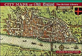

With the publication of The Theatre of the Empire of Great Britaine in 1611, John Speed launched Britain into the modern era of mapmaking. Speed (1552-1629) was an antiquarian who helped preserve many legends about Britain’s history, but his unique maps are his chief legacy. Speed’s atlas consisted of sixty-seven maps--complemented by descriptive and informative text--of all the counties and regions of England, Wales, Scotland, and Ireland. He acknowledged that the maps were based on the work of earlier surveyors, but his atlas offered a totality that no cartographer had accomplished. In addition, Speed’s atlas was notable because each map included a plan of the most important town in the county; in many cases Speed’s were the first maps of those towns ever printed. Whether Speed drew them himself we do not know: for one man to visit and map sixty or more towns scattered from Penzance to Berwick and from Canterbury to Carlisle would have been a monumental undertaking in Stuart-era England. It is more than likely that he commissioned the maps from local surveyors. If so, the maps were then edited by Speed to give them a unified style. The streets are shown in plan, and the principal buildings are drawn in elevation: the result resembles an aerial view.
On most of his maps, Speed provides a key to the streets and the main buildings. In some cases, the urban layouts show remarkable continuity with the modern-day cities, especially in Durham, Shrewsbury, York, and Ely, where physical geography or the presence of a castle or cathedral has kept change to a minimum. In other towns--such as Leicester, Newcastle, or Southhampton--Speed’s miniature maps serve as snapshots of historic town centers that have long since vanished. Speed’s drawings were engraved in Amsterdam by Jodocus Hondius, one of Europe’s foremost engravers, who returned the copper plates to London to be printed. Some copies of Speed’s groundbreaking atlas--including the source for these thirty postcards--were colored by hand for wealthy collectors.
Published with the British Library. Thirty full-color reproductions on oversized postcards measuring 6 1/2 x 4 3/4 in, all bound together in a handy collection. ISBN 978-0-7649-4050-7.
具体描述
读后感
评分
评分
评分
评分
用户评价
相关图书


本站所有内容均为互联网搜索引擎提供的公开搜索信息,本站不存储任何数据与内容,任何内容与数据均与本站无关,如有需要请联系相关搜索引擎包括但不限于百度,google,bing,sogou 等
© 2025 onlinetoolsland.com All Rights Reserved. 本本书屋 版权所有